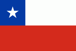
Purranque
Purranque is a city in the Chilean Los Lagos Region, which lies on the Pan-American Highway about 65 km north of Puerto Montt. It is part of the Osorno Province.
The first ethnically identifiable inhabitants of the area were Huilliches, an indigenous people, and the land belonged to Cacique (Chief) Raylef, who was known as "Cacique Don Raylef de Purranquil"; Purranquil meaning in Mapudungun language “bush land”.
The present city was founded on April 18, 1911 as ""Villa Lo Burgos de Purranquil"", by Tomás Burgos, in a plot of land 45 km south of Osorno, along the railroad line between that city and Puerto Montt. On November 24, 1941 the town was elevated to the category of city by law 6402.
Map - Purranque
Map
Country - Chile
Currency / Language
| ISO | Currency | Symbol | Significant figures |
|---|---|---|---|
| CLP | Chilean peso | $ | 0 |
| CLF | Unidad de Fomento | 4 |
| ISO | Language |
|---|---|
| ES | Spanish language |


